Historical, geoscientific or sociological topics displayed on maps
Maps and themed maps offer a myriad of ways to display information. Context and chronology are easily understandable.
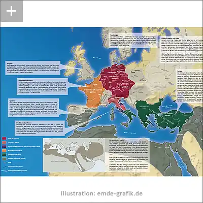
Illustration: Historical map of Europe at the end of the 10th century
More about this project for the History Journal „epoc“
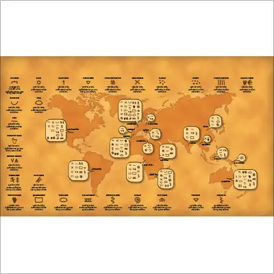
Illustration:
Map of historical characters all over the world
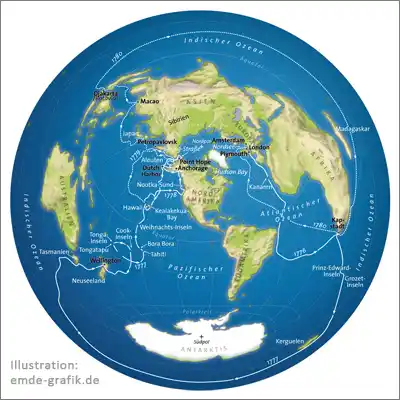
Illustration map:
James Cook’s trip around the world
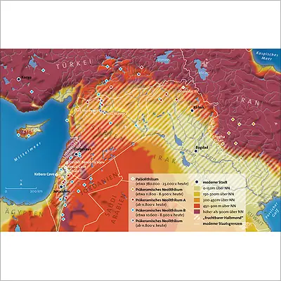
Illustration of a history map:
Pre-ceramic neolithic
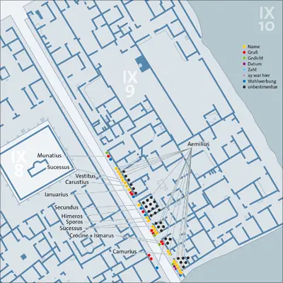
Illustration history city map:
“Graffiti” in ancient Pompeii
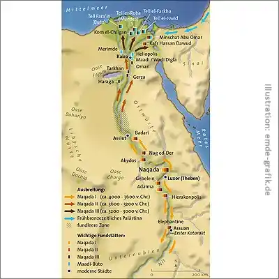
History map:
Naqada culture at nile
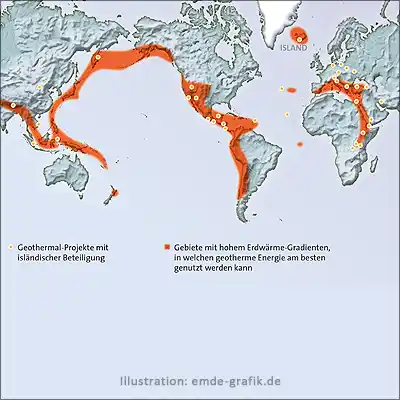
Geo science map:
Geothermal energy – vulcanism, the “ring of fire” around the pacific ocean
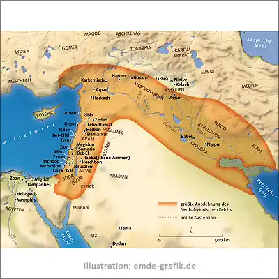
Historical map:
Neo-babylonian empire
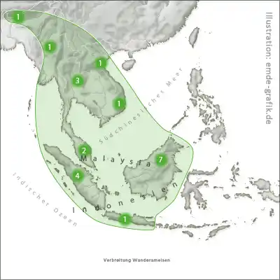
Geographical map:
Range of army ants in south east asia
Frequently asked questions about land and thematic maps (FAQ)
What is a country and theme map?
Themed maps are an excellent tool for gaining an overview as soon as regional events play a role. For example, when it comes to history: Which country had which expansion and when? What movements, migrations or campaigns took place and where did they go? What did the travel route of Marco Polo or James Cook look like? What was the city plan of ancient Pompeii?
What do I have to pay attention to when creating a themed map?
In addition to geographical accuracy, a scale and a small overview map for localization are important, especially when it comes to regional representations. Furthermore, experts who are well versed in the subject area are required. In contrast to many other information graphics, themed maps can also have a very high data density, because themed maps invite you to linger for longer. The more information, the more intelligently and clearly you must make the topic complexity visually distinguishable through signatures, colors (but always pay attention to people with red-green weaknesses), icons and typography.
Who are thematic maps for?
Primarily museums, scientific or political journals and publications.
What is the difference between a historical map and a history map?
That’s a bit of a trick question: a historical map, for example, is a piece of parchment that was created at the time of Columbus. So, I can’t make historical maps – you’d have to wait a few hundred years for it to become one. A map that shows Columbus’ route is a history map.
